
|
Creede Vacation Rentals
|

|
|
|
|
|
Creede Hotels and Resorts
|
|
|
| | | Hotels & Motels |
| Budget Host Ute Bluff Lodge | 27680 W Hwy 160 | South Fork, CO | 20.0 mi. | (800) 473-0595 | | Chinook Lodge And Smokehouse | 29666 W US Hwy 160 | South Fork, CO | 20.0 mi. | (719) 873-9993 | | Wolf Creek Ski Lodge & Motel | 13042 W Hyw 160 | South Fork, CO | 20.0 mi. | (800) 874-0416 | | Rocky Top Lodge | 1450 N Hwy 149 | Lake City, CO | 24.6 mi. | (970) 944-2780 |
| | | Bed & Breakfast |
| Old Firehouse Bed & Breakfast | Main St | Creede, CO | | (719) 658-0212 |

|
Creede Weather & Climate
|

|
|
|
Southwest Colorado has a four-season alpine climate. This region is on the Western Slope of the Continental Divide at 7,200 feet above sea level. The combination of high desert plateau and Rocky Mountains to the north and east create an unusually mild climate. Temperatures here are much cooler in the summer than most of the surrounding southwestern United States. The area is also blessed with 300 days of sunshine per year. The climate of Colorado, in general, is difficult to describe because it varies so widely from place to place. The climate of any particular place in this region is profoundly affected by differences in elevation, and to a lesser degree, by the orientation of mountain ranges and valleys and wind direction. Wide variations occur within short distances.
|
| Month |
High Temp |
Low Temp |
Rainfall |
Ocean Temp |
| January |
33°F |
-8°F |
0.46 in. |
- |
| February |
39°F |
-4°F |
0.60 in. |
- |
| March |
44°F |
4°F |
0.65 in. |
- |
| April |
49°F |
13°F |
0.76 in. |
- |
| May |
62°F |
24°F |
0.85 in. |
- |
| June |
72°F |
30°F |
0.79 in. |
- |
| July |
76°F |
37°F |
1.48 in. |
- |
| August |
73°F |
37°F |
2.40 in. |
- |
| September |
68°F |
28°F |
1.52 in. |
- |
| October |
59°F |
18°F |
1.37 in. |
- |
| November |
44°F |
5°F |
0.99 in. |
- |
| December |
33°F |
-6°F |
0.58 in. |
- |

|
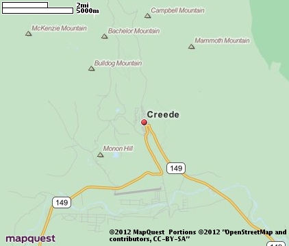
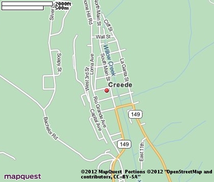
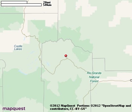
Creede Map & Transportation
|

|
|
 |
|
|
| Click each thumbnail image to enlarge. |
 |
|
 |
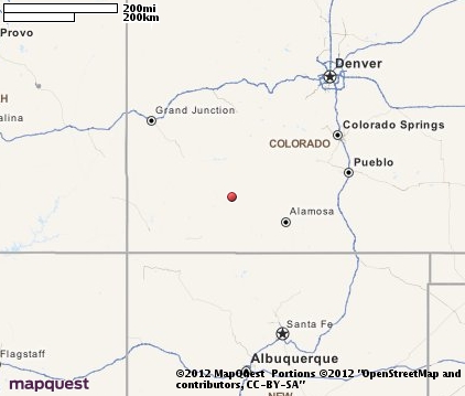 |
The closest airports in the area are Stevens Field (2V1) located about 40 miles south of Creede in Pagosa Springs, Colorado, the Gunnison Crested Butte Regional airport (GUC) located approximately 47 miles north of Creede in Gunnison, Colorado, the Durango La Plata County airport (DRO) located roughly 66 miles southwest of Creede in Durango, Colorado, and finally the Montrose Regional airport (MTJ) located around 69 miles northwest of Creede in Montrose, Colorado.
|

|
Creede Attractions
|

|
|
| | | Ski Areas |
| Telluride | Telluride | CO | 48.7 mi. | | | Purgatory | Durango | CO | 65.6 mi. | | | Crested Butte | Crested Butte | CO | 70.6 mi. | | | Aspen | Aspen | CO | 92.9 mi. | | | Aspen Highlands | Aspen | CO | 92.9 mi. | | | Snowmass | Aspen | CO | 92.9 mi. | | | Tiehack | Aspen | CO | 92.9 mi. | | | Ski Cooper | Leadville | CO | 102.7 mi. | | | Powderhorn Resort | Mesa | CO | 112.2 mi. | | | Red River Ski Area | Red River | NM | 114.9 mi. | | | Sunlight Mountain Resort | Glenwood Springs | CO | 119.5 mi. | |
| | | Museums |
| Fred Harman Art Museum | Pagosa Springs | CO | 40.3 mi. | (Art) |
Notice a problem with the information on this page? Please notify us.
|
Disclaimer: We recommend you conduct your own research regarding all accomodations and attractions found on this website. The distances shown on this website are straight-line distances as the crow flies. The road distance may be considerably longer. You assume all liability for use of any information found on this website. No information is confirmed or warranted in any way. By using our services you agree to the terms and conditions of this disclaimer.
|
| We are the #1 site for your Colorado Vacation presenting Colorado vacation rentals, hotels, weather and map for each city. |
Colorado Vacation .org
©1997-2025 All Rights Reserved.
|
|