 |
Paonia
is located on the North Fork of the Gunnison River in a large mountain valley in Delta County, Colorado. The name of the town is a derivative of the Peony flowers that were, at one time, very abundant in the area. Today, Paonia is still a very lush area that is known for its' wonderful climate and award-winning vegetables and fruit orchards (cherries are the major crop in the area.) The town itself has a population of approximately 1,600, with another 5,000 residents in the surrounding valley. The Paonia State Park is nearby and other attractions in town include the Bowie Schoolhouse Museum and Paonia Museum, which both offer a step back in time to the late 19th and early 20th centuries. Fishing, swimming, hiking and tubing are available in the area, and each July the town celebrates the Paonia Cherry Days with a parade, fireworks, barbecue and tons of cherry pies and other cherry delights. Paonia is also home to the nationally famous environmental paper, The High County News. There are two other major communities located in the North Fork Valley on Colorado's Western Slope - Hotchkiss, home to the annual North Fork Valley Bluegrass Festival and the town of Crawford, home to Crawford State Park and host to the annual Pioneer Days Festival.
Surrounding areas: Hotchkiss, Colorado (8.3 mi), Crawford, Colorado (11.4 mi), Cedaredge, Colorado (18.1 mi), Grand Mesa, Colorado (22.3 mi), Marble, Colorado (25.8 mi), Irwin, Colorado (26.6 mi), Delta, Colorado (27.1 mi)
|

|
Paonia Vacation Rentals
|

|
|
|

|
Paonia Hotels and Resorts
|

|
|
| | | Hotels & Motels |
| Comfort Lodge | 406 Hwy 133 | Hotchkiss, CO | 8.3 mi. | (970) 872-2200 | | Howard Johnson Express Inn | 530 South Grand Mesa Dr | Cedaredge, CO | 18.1 mi. | (970) 856-7824 | | Comfort Inn-delta | 180 Gunnison River Dr | Delta, CO | 27.1 mi. | (970) 874-1000 | | Riverwood Inn | 677 Hwy 50 N | Delta, CO | 27.1 mi. | (970) 874-5787 | | Montrose Comfort Inn | 2100 E Main St | Montrose, CO | 29.9 mi. | (970) 240-8000 |

|
Paonia Weather & Climate
|

|
|
|
West-central Colorado has a four-season climate that is either semi-arid or alpine, depending on location. Places that are just a short distance apart can have different weather. Valley areas have a semi-arid climate, while the mountains have an alpine climate. The wettest season in western Colorado is usually winter, while June is the driest month. Summers are mild in the mountains, sometimes with a high of only around 60 degrees F. Thunderstorms are possible, and sometimes cause the temperature to drop dramatically. At the higher elevations, winters are cold with lots of snow, but with abundant sunshine in between storms. Lower areas on western slope of the Rockies have summer temperatures similar to those on the plains - hot and dry.
|
| Month |
High Temp |
Low Temp |
Rainfall |
Ocean Temp |
| January |
38°F |
14°F |
1.22 in. |
- |
| February |
45°F |
21°F |
1.10 in. |
- |
| March |
54°F |
28°F |
1.48 in. |
- |
| April |
62°F |
34°F |
1.18 in. |
- |
| May |
73°F |
42°F |
1.45 in. |
- |
| June |
84°F |
50°F |
0.79 in. |
- |
| July |
90°F |
56°F |
1.14 in. |
- |
| August |
87°F |
55°F |
1.09 in. |
- |
| September |
78°F |
47°F |
1.37 in. |
- |
| October |
67°F |
37°F |
1.70 in. |
- |
| November |
51°F |
26°F |
1.38 in. |
- |
| December |
40°F |
17°F |
1.17 in. |
- |

|
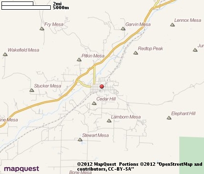
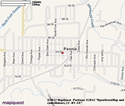
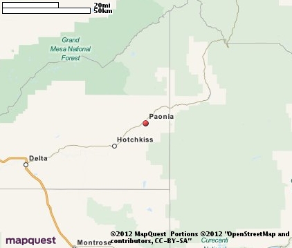
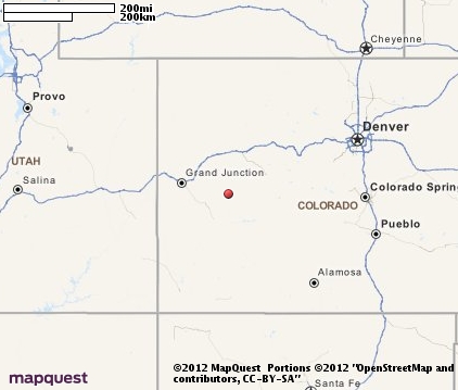
Paonia Map & Transportation
|

|
|
 |
|
|
| Click each thumbnail image to enlarge. |
 |
 |
 |
 |
The closest airports in the area are the Montrose Regional airport (MTJ) located about 29 miles southwest of Paonia in Montrose, Colorado, the Gunnison Crested Butte Regional airport (GUC) located approximately 42 miles southeast of Paonia in Gunnison, Colorado, Aspen Pitkin County Sardy Field (ASE) located roughly 45 miles northeast of Paonia in Aspen, Colorado, the Garfield County Regional airport (RIL) located around 46 miles north of Paonia in Rifle, Colorado, and finally Walker Field (GJT) located about 53 miles northwest of Paonia in Grand Junction, Colorado.
|

|
Paonia Attractions
|

|
|
| | | Amusement and Theme Parks |
| Fun Junction | Grand Junction | CO | 53.2 mi. | |
| | | Water Parks |
| Butch Cassidy King World Water Park | Moab | UT | 107.5 mi. | |
| | | Golf Courses |
| Deer Creek Village Golf Course | Cedaredge | CO | 17.8 mi. | | | Devils Thumb Golf Club | Delta | CO | 26.7 mi. | |
| | | Ski Areas |
| Crested Butte | Crested Butte | CO | 32.5 mi. | | | Powderhorn Resort | Mesa | CO | 35.8 mi. | | | Aspen | Aspen | CO | 47.2 mi. | | | Aspen Highlands | Aspen | CO | 47.2 mi. | | | Snowmass | Aspen | CO | 47.2 mi. | | | Tiehack | Aspen | CO | 47.2 mi. | | | Sunlight Mountain Resort | Glenwood Springs | CO | 49.3 mi. | | | Telluride | Telluride | CO | 65.4 mi. | | | Ski Cooper | Leadville | CO | 74.6 mi. | | | Beaver Creek | Vail | CO | 84.2 mi. | | | Vail | Vail | CO | 84.2 mi. | | | Breckenridge Ski Resort | Breckenridge | CO | 93.4 mi. | | | Keystone | Keystone | CO | 104.5 mi. | | | Purgatory | Durango | CO | 111.2 mi. | | | Loveland | Georgetown | CO | 116.7 mi. | | | Steamboat | Steamboat Springs | CO | 118.8 mi. | |
| | | State Parks |
| Chipeta State Park | | CO | 33.6 mi. | |
| | | Museums |
| Museum of Western Colorado | Grand Junction | CO | 53.2 mi. | (Multidisciplinary) | | Dinosaur Valley Museum | Grand Junction | CO | 53.2 mi. | (Science) |
Notice a problem with the information on this page? Please notify us.
|
Disclaimer: We recommend you conduct your own research regarding all accomodations and attractions found on this website. The distances shown on this website are straight-line distances as the crow flies. The road distance may be considerably longer. You assume all liability for use of any information found on this website. No information is confirmed or warranted in any way. By using our services you agree to the terms and conditions of this disclaimer.
|
| We are the #1 site for your Colorado Vacation presenting Colorado vacation rentals, hotels, weather and map for each city. |
Colorado Vacation .org
©1997-2025 All Rights Reserved.
|
|