 |
La-Veta
is a little town located in a very scenic area - the eastern side of Le Veta Pass through the Sangre de Cristo Mountains and at the northern opening of the Cuchara River Valley. Located in Huerfano County, in south central Colorado, Le Veta has a population of approximately 900, and it has become known throughout Colorado as an artist colony. Attractions in town include Fort Francisco, built in 1862, and the old train depot that is listed on the National Register of Historic Places. In 1876 the narrow gauge railroad came through Le Veta several blocks north of the Fort on its way westward through the newly surveyed Le Veta Pass. For many years, this stretch of the line between Le Veta and Wagon Creek was the highest in the world. The old grade can still be seen to the west of Le Veta and higher up across Old Le Veta Pass. Other attractions near Le Veta include the Scenic Highway of Legends, the San Isabel National Forest, the Great Dikes of the Spanish Peaks and The Dakota Wall. For recreation, Le Veta is one hour from the Great Sand Dunes National Park and hiking, biking, fishing, camping and horseback riding and golf are all available in the area.

|
La Veta Vacation Rentals
|

|
|
|
|
|
La Veta Hotels and Resorts
|
|
|
| | | Hotels & Motels |
| Knights Inn | 22808 Hwy 160W | Walsenburg, CO | 15.0 mi. | (719) 738-2167 | | Fort Garland Motor Inn | 411 Hwy 160 | Fort Garland, CO | 23.9 mi. | (719) 379-2993 |

|
La Veta Weather & Climate
|

|
|
|
South-central is a complex mix of mountains and desert. Since Colorado is a mid-latitude interior continental state, and has the highest elevations in the United States, weather can change dramatically from place to place. Southern Colorado is not always warmer than the northern part of the state, due to the elevation. Generally, the mountainous areas are cooler and wetter than lower elevations. Winters are cold and snowy, and summers are warm with temperatures in the 70s and 80s. Nights anytime of the year can be crisp in Colorado. Humidity is usually not a problem. Southern Colorado receives 300 days of sunshine per year. So, although there is plenty of snow in the wintertime, except at the highest elevations, it usually melts by mid-day.
|
| Month |
High Temp |
Low Temp |
Rainfall |
Ocean Temp |
| January |
47°F |
21°F |
0.70 in. |
- |
| February |
51°F |
23°F |
0.80 in. |
- |
| March |
56°F |
28°F |
1.80 in. |
- |
| April |
63°F |
33°F |
1.85 in. |
- |
| May |
72°F |
42°F |
1.95 in. |
- |
| June |
82°F |
50°F |
1.36 in. |
- |
| July |
85°F |
56°F |
2.13 in. |
- |
| August |
83°F |
55°F |
2.34 in. |
- |
| September |
78°F |
48°F |
1.04 in. |
- |
| October |
69°F |
37°F |
1.06 in. |
- |
| November |
55°F |
27°F |
1.45 in. |
- |
| December |
47°F |
21°F |
0.96 in. |
- |

|
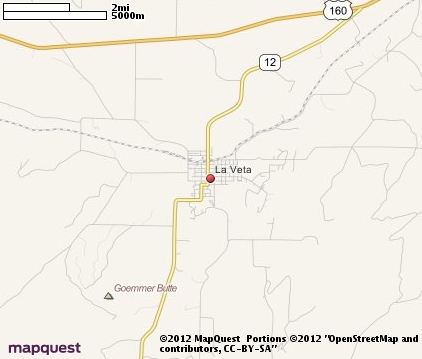
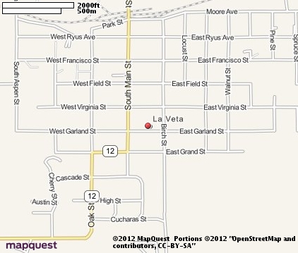
La Veta Map & Transportation
|

|
|
 |
|
|
| Click each thumbnail image to enlarge. |
 |
|
 |
 |
The closest airports in the area are the Silver West airport (C08) located about 40 miles northwest of La Veta in Westcliffe, Colorado, San Luis Valley Regional Bergman Field (ALS) located approximately 47 miles west of La Veta in Alamosa, Colorado, the Leach airport (1V8) located roughly 59 miles north of La Veta in Center, Colorado, and finally the Pueblo Memorial airport (PUB) located around 60 miles northeast of La Veta in Pueblo, Colorado.
|

|
La Veta Attractions
|

|
|
| | | Golf Courses |
| Grandote Peaks Golf Club | La Veta | CO | | | | Walsenburg Golf Course | Walsenburg | CO | 15.3 mi. | |
| | | Ski Areas |
| Red River Ski Area | Red River | NM | 59.3 mi. | | | Angel Fire | Angel Fire | NM | 78.3 mi. | | | Sipapu Ski Area | Vadito | NM | 97.9 mi. | |
| | | State Parks |
| Lathrop State Park | | CO | 11.3 mi. | |
| | | Museums |
| American Hall of Heroes Museum | Pueblo | CO | 56.2 mi. | (History) |
| | | Zoos and Aquariums |
| Pueblo Zoo | Pueblo | CO | 56.2 mi. | | | Cheyenne Mountain Zoological Park | Colorado Springs | CO | 92.4 mi. | |
Notice a problem with the information on this page? Please notify us.
|
Disclaimer: We recommend you conduct your own research regarding all accomodations and attractions found on this website. The distances shown on this website are straight-line distances as the crow flies. The road distance may be considerably longer. You assume all liability for use of any information found on this website. No information is confirmed or warranted in any way. By using our services you agree to the terms and conditions of this disclaimer.
|
| We are the #1 site for your Colorado Vacation presenting Colorado vacation rentals, hotels, weather and map for each city. |
Colorado Vacation .org
©1997-2025 All Rights Reserved.
|
|